Pacific Crest Trail
Thru-hiker
2014
In 2014, I had the fortune to thru-hiked the Pacific Crest Trail over the course of five months. This unique trail spans 2650 miles and over 450,000 feet of vertical climbing across California, Oregon, and Washington.
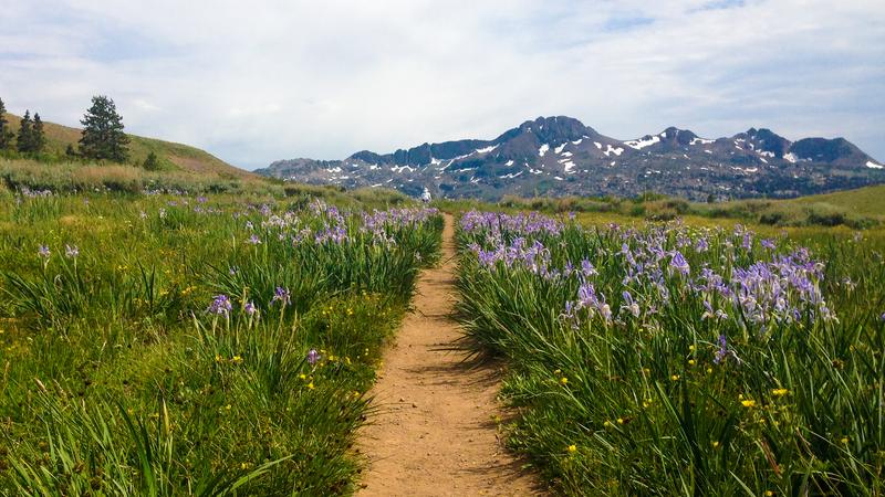
A bed of Blue Irises line the trail near Carson Pass.
In 2014, I had the fortune to thru-hiked the Pacific Crest Trail over the course of five months. This unique trail spans 2650 miles and over 450,000 feet of vertical climbing across California, Oregon, and Washington. The trail traverses through the Sierra and Cascade mountain ranges, and passes through national landmarks such as the Mojave Desert, Mt. Whitney, and Crater Lake.
I started my hike from the Mexican border on May 2nd, 2014 and finished my hike at the Canadian border on September 15th, 2014.
Motivation
Towards the end of my tenure at Inkling, I knew that I wanted to take some time off before jumping straight into my next job. I remember setting my intention on the eve of 2014 that the next year would be one of movement. In my initial vision, I thought I would be traveling the world visiting friends and exploring different cultures. But at some point it hit me that almost all of my travels up until that point had been international and I was not giving enough credit to my own backyard.
When I started learning more about the beauty that California had to offer, I eventually came across the Pacific Crest Trail. My heart immediately knew that this was the one. I loved the idea of spending nearly half a year in nature not that far from home – living out of a tent with only the belongings you carried on your back.

Preparation

Me doing a training hike on the Cone Peak Trail in Big Sur, CA.

All of my initial gear the night before heading out to the PCT trailhead.
When I made the decision to do the PCT, an intense period of preparation first lay ahead of me. I had experience doing weekend trips and occasional week-long trips around the Bay Area but none of it quite prepared me for what I needed for this trip.
I needed to learn what it mean to traverse scorching hot deserts, snow-packed passes, and cold rushing rivers. I would need to understand how to pack and eat in order to hike thirty miles a day. I would need to understand how and where to resupply my food, fuel, and water. And I needed to learned what to do in case I, or someone I knew, got injured in the wild.
While I did a lot of research on proper equipment online, nothing beats putting equipment to the test on the trail, comparing notes with other thru-hikers, and really iterating on what things you really need. While I started off the trail with one set of gear and an initial base weight of 20lbs, I ended up with radically different set of gear with a final base weight of about 12 lbs. This optimization and nearly 50% reduction in base weight made an enormous difference in my speed and happiness while hiking.
A few resources that were incredibly helpful during this part of the process included Yogi’s PCT Handbook, Guthook’s PCT Mobile Guide, Craig’s PCT Planner, Outdoor GearLab, and the annual PCT Facebook group.
Getting to the Trailhead
Getting to the trailhead in Campo, CA would have been significantly more difficult without the generosity and dedication of a few key families in San Diego. The month before I left, I corresponded with a couple named Scout and Frodo, who hosted would host up to forty hikers a night every day for the good part of a month. They agreed to put me up.
When I arrived at the San Diego Airport, I was greeted with a car marked by pink fluffy pom poms. They took me and the seven other hikers that day to their house, let us set up camp at their house, cooked us a hearty dinner, and gave us their words of wisdom before we headed out on the adventure of a lifetime.
The next morning, we awoke at 4AM and were driven out to the trail by a host of volunteer drivers. I was as nervous as I had ever been but, as we approached the the Mexican border, it quickly turned to excitement. We arrived at sunrise and the southern terminus looked epic.

Hikers taking turns helping out with dinner at Scout and Frodo's the night before starting the trail.

The southern terminus of the trail in Campo, CA – only a few feet from the US-Mexican border.
I had been planning for this moment for the last three months but as I took my first steps northbound, I felt a clarity come over me. All of the fantasies, dreams, fears, and confusion evaporated and what I was doing became real for the first time.

Southern California


Sun umbrellas were a crucial piece of gear when hiking in the open heat of the desert.
The trail is commonly divided into five sections. The first section of Southern California is 700 miles through mainly desert and forest terrain and is marked with a strange beauty. Stark deserts that give rise to beautiful alpine forests. These high altitude and cool forests offer a temporary respite as you know you’ll be back in desert in a few days at most.
Because of the intense heat during the desert sections, hiking schedules during this section were often flipped – hiking during the night and finding a shady spot during the afternoon to nap. Given the development in this region, the hike included numerous roadwalks and frequent small town stops.


Hiking during the early dawn hours in the Mojave Desert
Because this section is quite dry, there are many people who leave hundreds of gallons of water in key locations to make sure hikers can stay hydrated.
This was my first experience with trail magic – an unexpected occurence that lift’s a hikers spirit. Trail magic is usually left by trail angels, people committed to helping hikers out of the goodness of my heart.
Scout and Frodo, the couple who helped me to get to the trailhead, were the first trail angels I met but they were certainly not the last. Families throughout the trail would open up their homes, showers, and food to hikers along the way. Sometimes these were humble operations who’d host maybe three to four hikers at a time. Others were near-professional operations with showers, foot soaking stations, cafeterias, and hourly van runs to grocery stores and REI’s.

Hikers finding respite from the scorching afternoon sun under a sole tree in the desert.

Pure bliss as we stumbled across a trail magic dumpster full of apples, cold soda, and bubble wands.

Stinky hikers trying their beset to get a hitch into town.
Generally, we’d stock up for five to ten days of food until we’d get to the next trailhead. There, we’d usually emerge in the middle of a remote highway where we’d have to hitch hike into the nearest town.
In town, we’d shower, do laundry, and stock up on food for the next section. If we felt like rewarding ourselves (which we usually did), we’d ask around for the best place to get a pizza, burger, or burrito. Perhaps, we’d even find a hostel or motel to rest in for the night before returning to the trail.

Grandpa happy to have a warm cozy bed for the night.

A burger in town that I was looking forward to for days.
As this is the first section of the hike, you are constantly discovering the richness of trail culture. Hikers are quite social at this stage, wanting to make friends and hear about how everything else came to this crazy decision.
Early on, I met three hikers named Duke, ET, and Pepa. The gave me great advice on ultralight hiking, anointed me with my trail name, “Tank,” and are good friends until this day. Duke and ET also happened to be filmmaker friends from Texas and made an beautiful documentary of their trip called “Do More With Less.” I highly recommend it to anyone interested in learning about the PCT.

Horsing around with Pepa, Duke, and ET at sun down.
Central California

The end of Southern California was marked with my arrival at Kennedy Meadows. As I turned into this remote campground after 700 miles of mainly desert, I was greeted by the cheer and applause of a dozen hikers sitting on the porch with cold beer in hand.
I rested here for a few days and also changed out my tent and shoes. Afterwards, I ascended into the Sierras and was rewarded with 500 miles of some of the most pristine and beautiful wilderness in all of the United States.

Arriving at Kennedy Meadows, the gateway to the Sierras.

Blissfully ascending into the Sierras from Kennedy Meadows.

It was rejuvenating to see such an abundance of water after a month in mostly desert.


An almost perfect mirror lake below Kearsarge Pass.

Atop the summit of Mt. Whitney – the highest point in the continental US.
Every day in the Sierras start with a mountain pass. You want to hit these early in the morning before the snow has a chance to melt in order to avoid postholing. Each pass requires a tough 2000–4000 ft climb at high attitude but it is worth it. Not only do you feel like you’ve conquered something significant, but you are also rewarded with an entirely new view on the other side.
As you climb down, you feel like you are descending nature’s staircase. Glaciers trickle down into alpine lakes, which then in turn waterfall down to lower lakes below. Every step down you take, life becomes more abundant until you hit the lush forests and meadows at the base of the valleys where you camp that night.
The next day, it starts all over - another pass, more lakes and more meadows.

The final ascent up to Mt. Whitney from Crabtree Meadows.

A typtical descent from a mountain pass.

The majestic Guitar Lake.


Golden hour was reliably magical every day.

One of the most beautiful things about the PCT are the friendships that develop between people who would have never crossed paths in normal life. Even though we probably would not have become friends in our city lives, we connected on a more human level and our differences in life off the trail didn’t seem to matter so much. Getting to meet people like this and realizing how much you share with someone so seemingly different was one of my favorite parts of doing this trail.
Most of the Sierras I hiked with Pepa, a preachy and energetic twenty-two year old from Virginia. Although he was five years my younger, he seemed full of trail and life advice - sometimes spot on, sometimes horribly cliche. Having already hiked half of the Appalachian Trail two years ago, he was always teaching me new trail vocabulary and sayings. When we weren’t talking about the trail, we would reflect about our lives back home - career paths, friendships, relationships, and all the things that made life worth living.

Pepa, relieved, after our descent down from Forester Pass.

Pepa, Promise, Duke, and ET taking a break at the top of Muir Pass.
The Sierras wind down with your arrival at Yosemite National Park There, I spent a week hanging out and recounting stories with friends back home from San Francisco. Every time I hiker I knew arrived at the campground, my friends would invite them in, have way too much fun feeding them, and enjoying hearing their stories.
In Tahoe, my parents came to visit and made sure I had enough to eat. On the last day, I brought them out to the trail to hike and enjoy the wildflowers. Their departure marked the official end of Central California section.

Kaity joined me for the portion between Red's Meadow and Tuolumne Meadows.

Kaity sitting below Cathedral Peak in Tuolomne Meadows.

My friends Sharon, Stephen, David, and Dana joining me in Yosemite for the week.

My dad and mom having a dinner with me on their visit to Lake Tahoe.
Northern California

After a month of the euphoria generated by being in the Sierras and seeing loved ones, starting the Northern Californian section was an emotional trough for me. I had crossed the deserts of Southern California and made it through the beautiful but demanding Sierras. While I was ecstatic when I hit the 1000 mile point, it was beyond sobering to realize that I still had 1700 miles to go. Spending over a week in Yosemite and Tahoe meant that most of my hiker friends were hundreds of miles ahead of me on the trail.

Coming across the thousand mile maker was a surreal moment.

Staring over into the Sierra Buttes.


The county store in Sierra City. What was once a booming gold rush city was now a sleepy small town tucked into the Sierra foothills.

Mt. Shasta in the distance.

In this moment of solitude, I turned my attention towards nature. It was early July, and wildflower season was in full bloom. I developed a fascination for trying to identify all the different types of flowers and trees around me. Where before I saw pine trees, I now saw Western Whites, Red Firs, Mountain Hemlocks, and Lodgepole Pines.
Flowers were no longer just petals of different colors but individual species - Lupine, Elephant Heads, Indian Paintbrushes, and Shooting Stars. It felt satisfying to know that the living world around me had a name. Learning all of this really changed the way I appreciated the natural world around me.

A patch of Slendertube Skyrockets.

A field of Lupine and Indian Paintbrushes.

My favorite wildflower sightings were always the aptly named Elephant Heads.

A bed of Ponderosa Pinecones.
As I approached the end of this section, wildfire season broke out. The last hundred miles of trail in Northern California was burning when I arrived.
In a twist of fate, I hitchhiked into the town of Etna to seek refuge and found that many of my hiker friends were hunkered down there also waiting for the fire to pass. It was a glorious celebration to be reunited and when we all realized that the fire wasn’t going away any time soon, we all set out together on an 80 mile walk along the highway into Oregon.

A nearby fire shut down the last 100 miles of trail in Northern California.


A smoky and joyful reunion dinner in Etna, CA.

Railroad hiking into Oregon.
Oregon
Words could not describe the accomplishment I felt when I finally walked across the border into Oregon. Even though we had arrived on an unmarked back road to avoid the wildfires, an enormous mental load lifted knowing that all of California was behind us. The dry, hot, and harsh forests of Northern California descended into the general rolling hills of Oregon and the Sierra Mountain Range gave way to the Cascade Range.
My friends and I spent a few days celebrating and reseting in Ashland before making our way over to Crater Lake. There, my friend Duke’s mom was waiting for us and invited us to stay with her at the luxurious Crater Lake Lodge. To this day, the morning we woke up with hot coffee in hand to the blazing orange sherbet sunrise over the ridge of the volcanic lake is seared into my mind.

Celebrating at the border of California and Oregon on a small backcountry road with Duke and Leatherfoot.

A triumphant arrival at Crater Lake.

Watching the sunrise at the majestic Crater Lake Lodge.
Partly due to the terrain and partly due to the excitement of finishing Northern California, hiking through Oregon felt like gliding through butter. I clocked some of my highest mileage days averaging 35 miles a day and topping out at 44 miles. I still vividly my hikes in the gentle Oregon forests, passing the serene lakes, through the Three Sisters Wilderness, and around Mt. Washington, Mt. Jefferson, and Mt. Hood. If I had to choose a phrase that describes how I felt throughout this entire section, it would be at peace.

Filling up water before the storm below the Three Fingered Jack.


Seeking refuge from the rain at Maiden Ski Lodge.

Hiking the Three Sisters with Jane and Tarzan.

Mt. Jefferson in the distance.


At one moment, I remember making a brief detour to stay in Bend, OR and found myself in the middle of a craft beer festival with every hostel and hotel sold out. I remember wandering aimlessly decided what I should do when someone fixing his bike in his garage called out to me. He turned out to be a former PCT hiker who went by the trail name Turducken.
He offered to put me up in his house for a few days and took me around Bend and introduced me to his friends. This idea of Paying It Forward was something that I encountered regularly on the trail and, to this day, inspires my relationship with others in need.
Washington

Staring back into Oregon over the Columbia River.

Walking across Astoria–Megler Bridge from Oregon into Washington was a bittersweet moment. I had been anticipating hiking in the magical old growth forests of the Washington Cascades since I started planning. Yet, I knew that finishing the last 500 miles of this state marked the end of this journey. Along with everyone else, it instilled us with a mindset to be truly grateful for every day we had left.

Approaching Mt. Adams with a new friend, Sock Holiday.

Making our way through the Goat Rocks in the rain clouds. It was a part of the trail I was really excited about but didn't end up seeing much that day.

Hanging out with Big Boots, Seamstress, Bomber, and Big Boots at Mike Ulrich Cabin.

I knew that the Washington section of the hike was renowned but I was not prepared for how profoundly beautiful it was. If hiking the Sierras felt like you were floating in the clouds above a sea of majestic granite, hiking the Washington Cascades made you feel like you were engulfed by an ancient green civilization of thousand year old trees, moss, and ferns.


Hiking through Glacier Wilderness. This was hands down my favorite portion of the Pacific Crest Trail.

The last two weeks of the hike, slowed our pace down significantly. We made small campfires every night and savored each of our remaining sunsets. I was eager to reunite with loved ones back home but I also desperately did not want this chapter of my life to end.

Coppertone was a celebrity on the PCT. He drove around in his RV and welcomed tired hikers at trailheads with root beer floats.

Resupplying in Stehekin, a small community at the northern end of Lake Chelan, with Squeaker and Worm.

On September 15th, 2014, I remember having an early afternoon tea time with a few hiker friends before making our final descent down in to the northern terminus of the trail. The final marker of the trail was just as humble as the beginning marker. A few wooden poles marked with the infamous triangular PCT seal and a metal box with a notepad and pen to log your completion.
For the last five months, I had only identified to myself as Tank and only referred to others by their trail name. After soaking in the enormity of this trip for a few hours, we got up, shook hands, and introduced ourselves by our real names for the first time. Then we put our packs back on, walked across the Canadian border, and hiked the remaining seven miles to a small roadside inn where my father was waiting for me.

A last afternoon tea time with Squeaker, Worm, and Sock Holiday.

Celebrating the finale at the Northern Terminus.
Getting Home
For the last month I was hiking, I remember debating furiously with other hikers what our first meal off the trail would be. Mine was going to be a steaming bowl of Pho. My dad and I drove into Vancouver and stayed with my cousins for the next week and I had my bowl of Pho along with plenty of other great asian food. My family was horrified by how much weight I had lost – I went 165lbs to 140lbs over the course of those five months.
After a wonderful week with family in Vancouver, I took the train down to Seattle where a few good friends had flown up to meet me. We rented a car and slowly roadtripped back down to San Francisco enjoying lots of great food, beer, and coffee along the way.

Hanging out with my little niece in Vancouver.